
About The Project
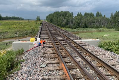
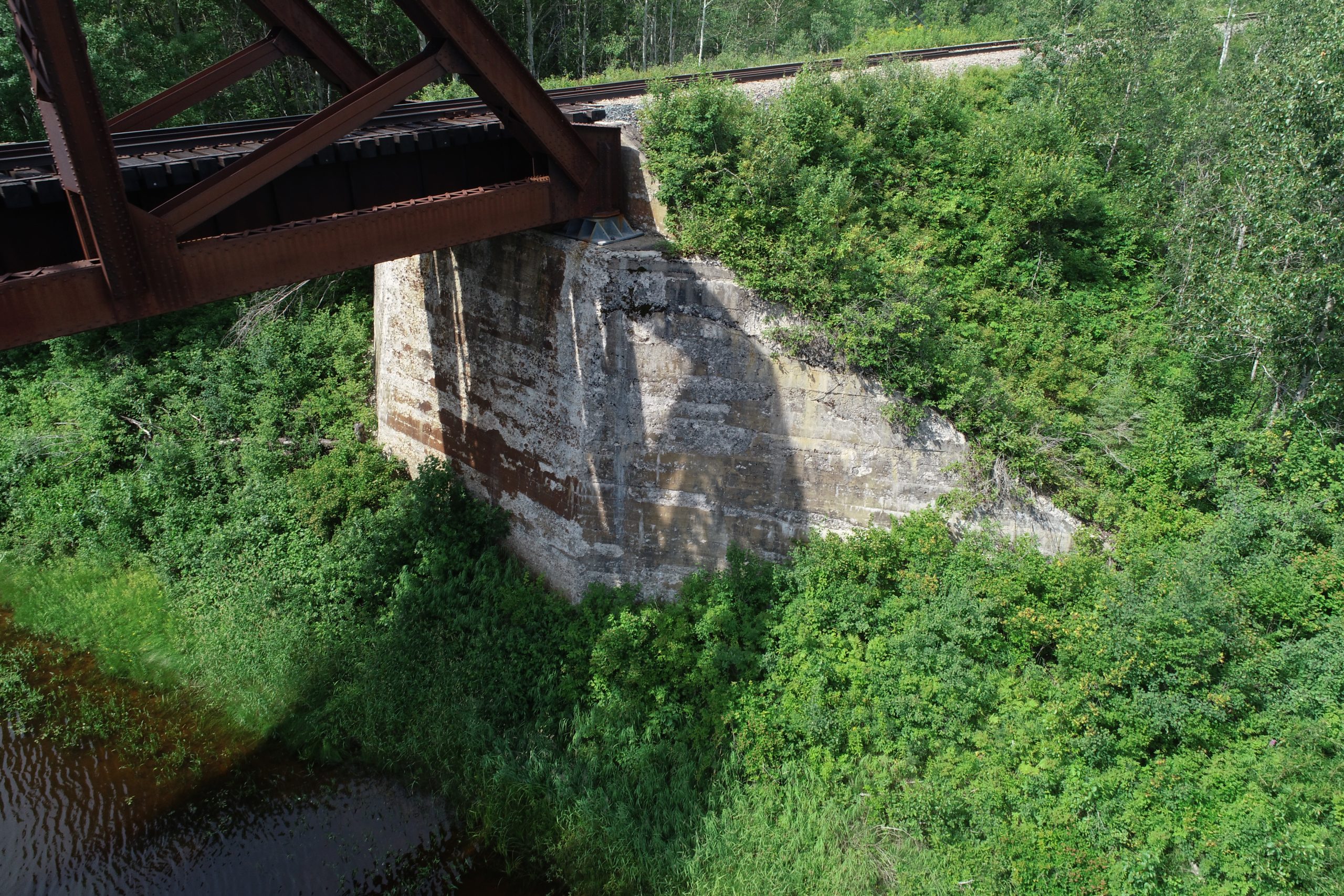
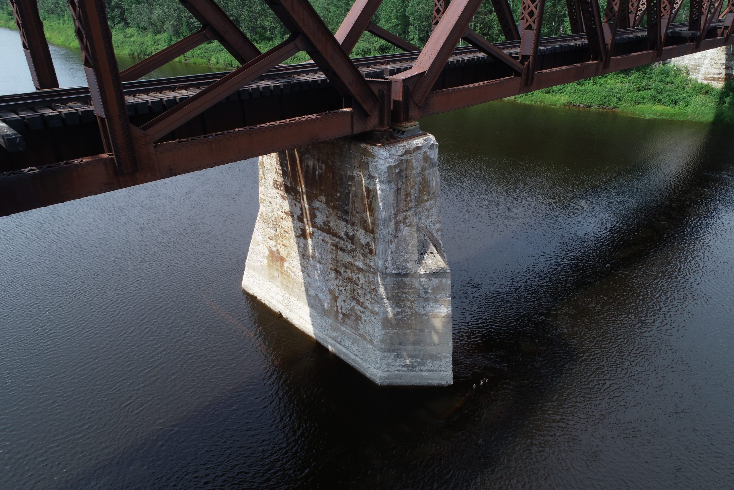
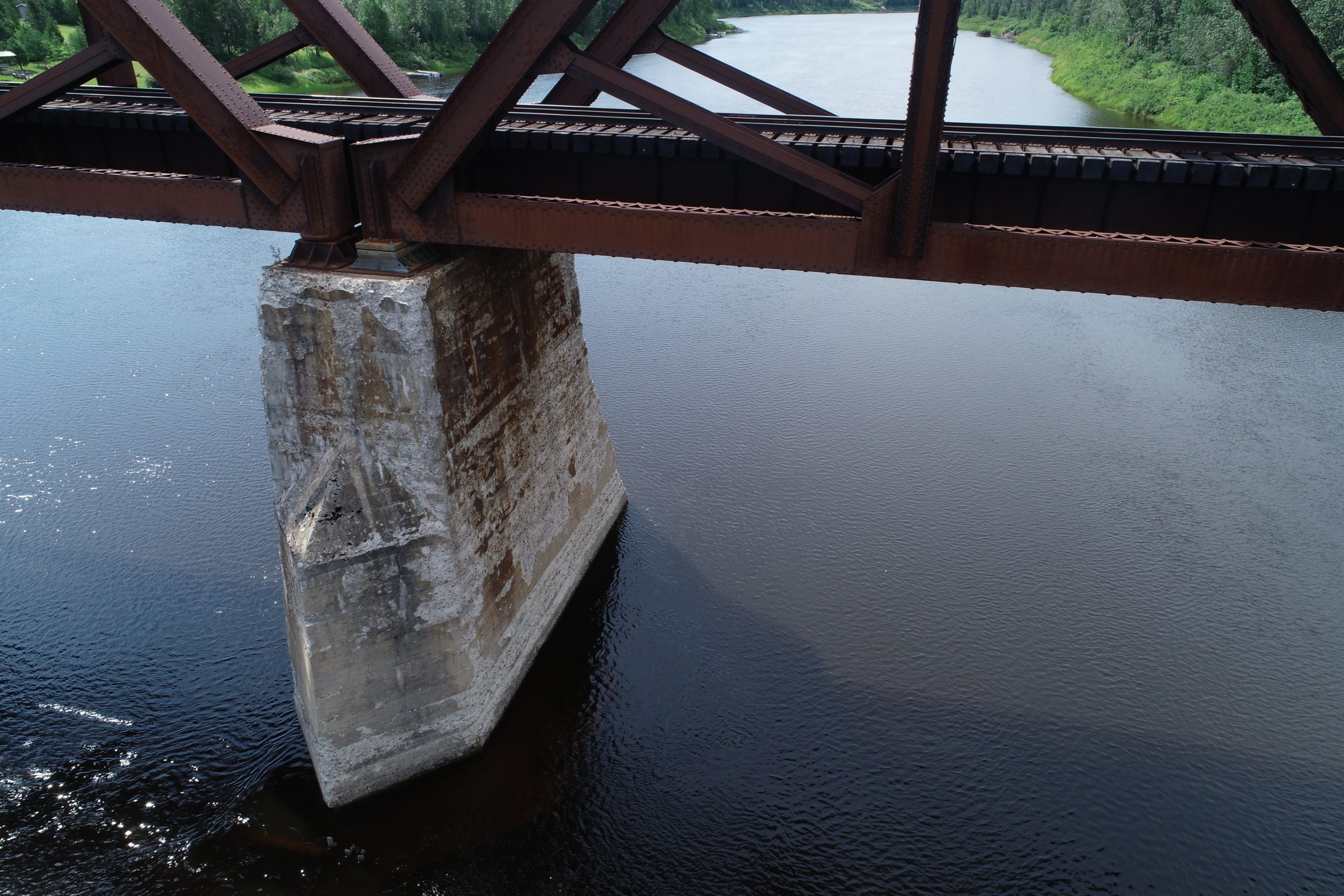
Stationary LiDAR scanning of concrete substructure at rail bridge (Kapuskasing Mi. 50.2, Fauquier).
Scanning of the concrete structural elements included the 2 concrete backwalls and the central pier. Scanning was completed from all available vantage points to capture the required data, from points on track level and at ground level near the water’s edge. Top of rail points were also taken with the total station equipment.
Groma’s GIS team extracted the required structural elements from the stationary LiDAR point cloud, for inclusion in a CAD survey base plan. The team also produced PDFs showing the dimensions of the substructure.
Services Provided

3D Laser Scanning
With scanning, we provide our clients with a fast and easy solution to gather large quantities of information with a high degree of accuracy. Using the 3D laser scanner to gather point cloud data that contains both location and RGB information makes it easy for Groma’s customers to dimension and display cross sections. Point clouds are easily imported into AutoCAD or can be dimensioned right on the web using online tools.
GPS/Total Station
Our field teams use Leica robotic Total Stations, Leica, Trimble, and Topcon GNSS units and Leica DNA03 digital levels to provide a wide range of services for projects of any size; includes topographical surveys, construction layout, control networks, deformation monitoring, site volume calculations, as-built surveys and much more.
