


About The Project
Topographic survey of 7 streets within the City of Toronto for future design considerations. 6 of the streets were surveyed with conventional GPS and total station methods, with all features in the road allowance captured.
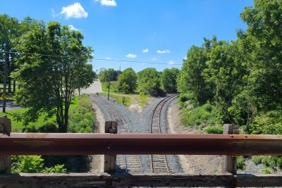
A 1km section of Dundas Street in the Regent Park neighborhood was captured with mobile LiDAR scanning, due to the amount of traffic during daytime hours. Scanning targets were set along both sides of the road to reference the scans to the City of Toronto coordinate system (MTM10 NAD27), tied into the City’s vertical benchmarks and HCMs.
The client received 2D & 3D survey base plans, in addition to DTMs of each site.
Services Provided

GPS/Total Station
Our field teams use Leica robotic Total Stations, Leica, Trimble, and Topcon GNSS units and Leica DNA03 digital levels to provide a wide range of services for projects of any size; includes topographical surveys, construction layout, control networks, deformation monitoring, site volume calculations, as-built surveys and much more.
Mobile Scanning
Groma possess mobile scanning technology to quickly survey large and complex areas. The mobile scanner can be attached to a van or hi-rail truck, and driven through site to collect survey information in a point cloud representation. This cuts down on time spent on site, and produces the same deliverables with the same accuracy as conventional GPS/Total Station surveys.
